|
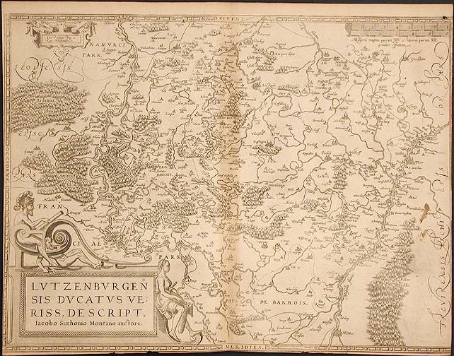
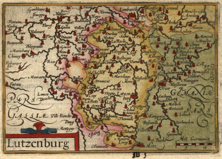
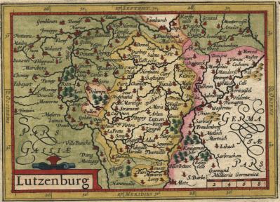
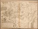
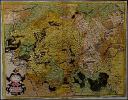
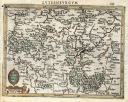
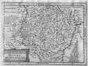
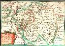
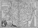
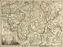
Lutzenburgensis Ducatus (1579). This map was engraved by Franz Hogenberg for Abraham Ortelius' famous atlas, Theatrum Orbis Terrarum. The first edition of Theatrum to include this first state of the map was published by Christophe Plantin in 1579. The map is based on the oldest known survey of Luxembourg conducted by Jacques de Surhon (Iacobo Surhonio) for Emperor Charles V in 1551. It was not published for several years because of military security restrictions. [Vekene 1.02.A]
|
|
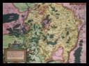
Lutzenburgensis Ducatus (1581). Engraved by Abraham de Bruyn (1540-1587), this map is essentially a copy of the map engraved by Hogenburg for Ortelius (see above), but with a different cartouche. It is from Lodovico Guicciardini's Descrittione... di tutti i Paesi Bassi... which was published by Christophe Plantin in Antwerp. [Vekene 1.03]
|
|
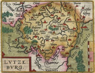
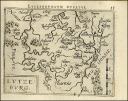
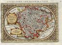
Lutzeburg (1583). Engraved by Philippe Galle (1537-1612) for Abraham Ortelius and published by Christophe Plantin. It is from Epitome Theatri Orteliani (second Latin edition), a small-format edition of Ortelius' great folio atlas of 1570. [Vekene 1.04.A]
|
|
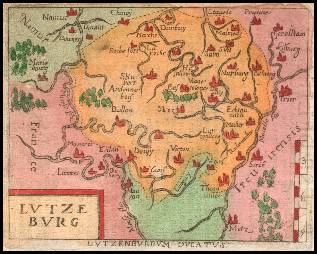
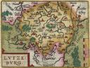
Lutzeburg (1602). Engraved by Philippe Galle (1537-1612) for Abraham Ortelius and published by Jan Baptist Vrients. This is very similar to the previous map, but with minor changes to the cartouche and the addition of directional indicators (Occidens, Meridies, and Oriens) and more towns. [Vekene 1.04.B]
|
|
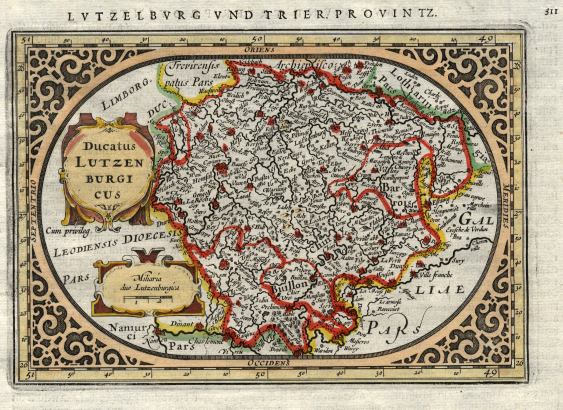
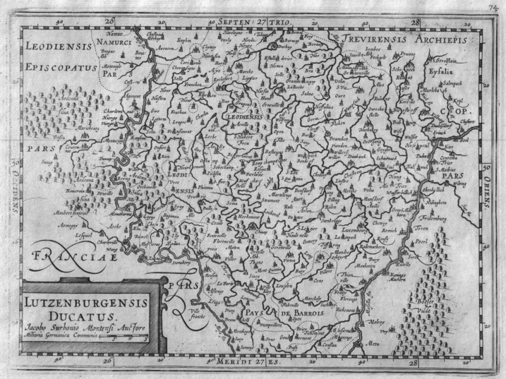
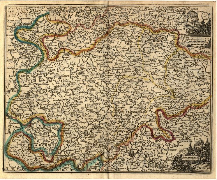
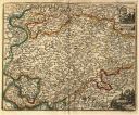
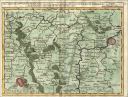
Trier & Lutzenburg (1585). Engraved and published by Gé rard Mercator (1512-1584). This map first appeared in Belgii inferioris Geographicae tabulae in 1585 and was republished in several different atlases up to 1633. [Vekene 1.05.A]
|

|
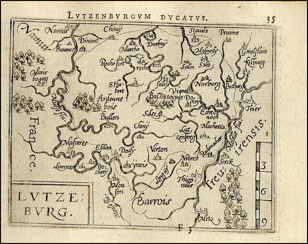
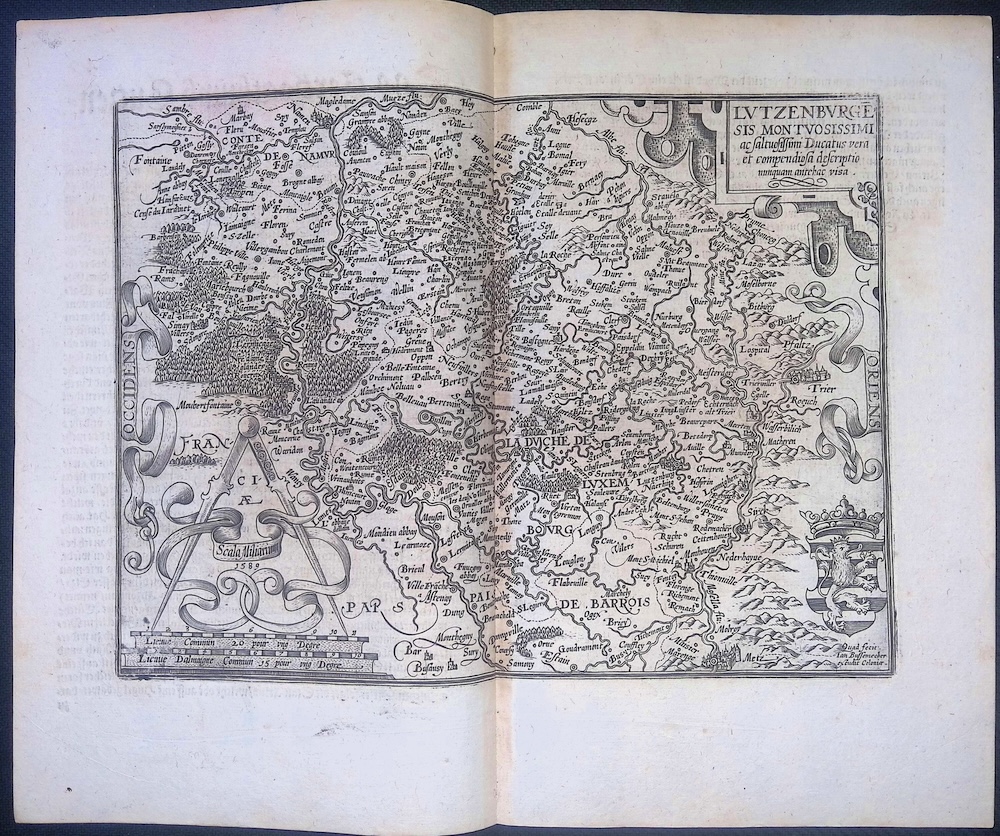
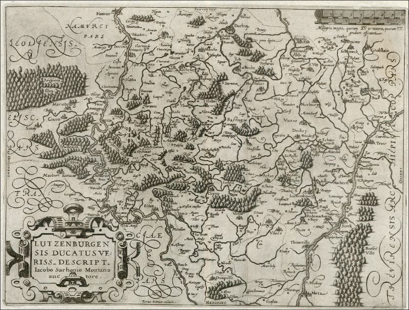
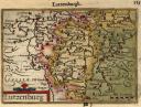
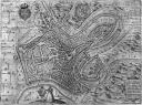
Lvtzenbvrge Sis Montvosissimi (1589). Engraved by Matthias Quad (1557-1613) and edited by Johann Bussemacher. [Vekene 1.07]
|
|
Lutzeburg (1655). This map was copied from the 1583 map engraved by Philippe Galle (see above) by an unknown Italian engraver. It was first published in 1598 by Compagnia Bresciana although this state is from the 1655 Theatro del Mondo di Abraamo Ortelio by Turrini. [Vekene 1.08]
|
|
Lutzenburg (1599). Engraved by Pieter van den Keere (1571-1640) and published by Cornelis Claesz. This state of the engraving, with degree 50 of latitude included, first appeared in the second edition of Caert-Thresoor. Claesz acquired the rights to publish Caert-Thresoor by Barent Langenes in 1599. [Vekene 1.10.B]
|
|
Lutzenburg (1603). Engraved by Ambroise & Ferdinand Aertsen. From the English edition of Epitome Theatri Orbis Terrarum. This was a pocket-size edition of Theatrum Orbis Terrarum by Abraham Ortelius. [Vekene 2.01]
|
|
Trier et Lutzeborg (1607). Probably engraved by Jodocus Hondius I and published by Hondius/Janssonius who had inherited the business of Mercator. From Atlas Minor Gerardi Mercatoris à I. Hondio plurimus aenies tabulis auctus atque illustratus. [Vekene 2.02]
|
|
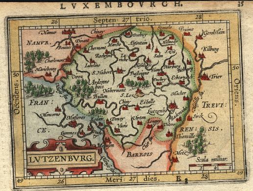
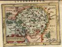
Lutzenburgensis Ducatus (1609). This map was designed by Jacques de Surhon and engraved by Pieter van den Keere. It first appeared in Guicciardini's Description de touts les Pays-Bas. [Vekene 2.03]
|
|
Ducatus Lutzenburgicus (1635). Engraved by Abraham Goos. From a German edition of the Jan Jansson Atlas Minor, first published in 1628. [Vekene 2.05.B]
|
|
Lutzenburg (1616). Engraved by Pieter van den Keere and published by Jodocus Hondius II. Hondius II, the son of the famous cartographer and engraver Jodocus Hondius I, became the editor of Caert-Thresoor after the death of Cornelis Claesz. [Vekene 2.06]
|
|
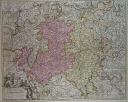
Lutzenburgensis Ducatus (1676). This map was published by Joannes Janssonius van Waesberge in Nieuwe en beknopte uytbeeldinge en vertooninge der gantscher Aerdboden. It is based on an engraving done in 1609 by Pieter van den Keere (see above) and Jacques de Surhon's original 1551 survey. [Vekene 2.09.b]
|
|
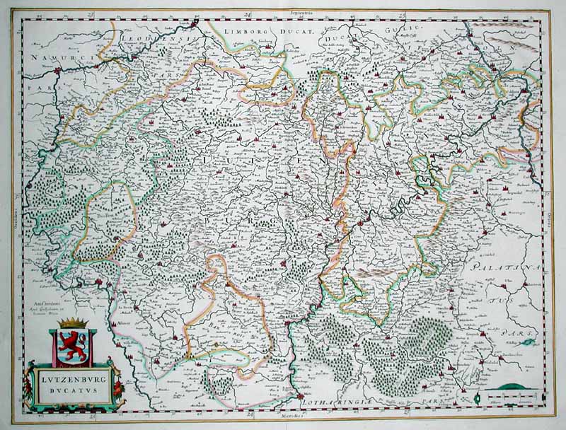
Lutzenburg Ducatus (1640). This map by Willem Janszoon Blaeu was published for the first time in the second volume of Theatrum Orbis Terrarum sive Atlas novus, published by the Blaeu firm in Amsterdam. [Vekene 2.12.B]
|
|
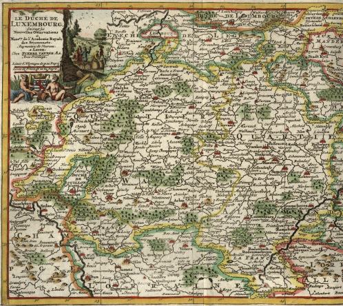
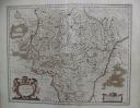
Le Duché de Lux-embourg (1702). This map, oriented to the west, was published by Daniel de La Feuille (1640-1709); the cartographer was Jacob Aertsz. Colom (1599-1673). This state, with La Feuille's name in the cartouche, first appeared in the La Feuille's Atlas portatif of 1702. An older version of the same map, identical except for the text in the cartouche, was first published by Colom in 1635. [Vekene 2.13.C]
|
|
Ducatus Lutzenburgensis (1645). Engraved by Joannes Janssonius II. This state of the map, bearing the place of publication (Amstelodami) and Janssonius's name next to the cartouche, was published for the first time in 1645 in the Nieuwen Atlas Ofte Weereldt- Beschrijvinghe Tweede Deel. Inhoudende Nederlandt Vranckrijck en Hispanien. [Vekene 2.15.B]
|
|
Carte du Duché de Lvxembovrg (1675). This map is the work of Sébastien de Pontault de Beaulieu. It was originally published in Les Plans et Profils des principales Villes et lieux considerables du Dvché de Lvxembourg. [Vekene 2.25.B]
|
|
Lutzenburgi (1692). This map was engraved by Jacques Harrewijn (1660-1727) and first appeared in L'Atlas en abrégé ou Nouvelle description du monde, tirée des meilleurs Auteurs de ce siècle. It was published by Jacques Peeters of Antwerp. [Vekene 2.34]
|
|
Ducato di Luxembourgo (1692). Engraved and published by Vincenzo Maria Coronelli, a Franciscan priest from Venice. Coronelli (1650-1718) was most famous for his terrestrial and celestial globes, however he also created over 500 maps, including those in his Atlante Veneto. He also founded the Academia Cosmografica degli Argonauti, the world's first geographical society. [Vekene 2.35]
|
|
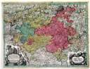
Luxemburgensis Ducatus, Tam In Ejusdem Minores, Quam Principales Ditiones Peraccurate Distinctus (1690). This map was engraved by Gilliam van der Gouwen. It was published by Nicolaes Visscher II (1649-1702) in his Atlas Minor of 1690-98. [Vekene 3.01.A]
|
|
Le Duché de Luxembourg (1712). This map was published by Pieter van der Aa (1659-1733). It first appeared in Le nouveau Theatre du Monde ou la Geographie Royale. [Vekene 3.06.A]
|
|
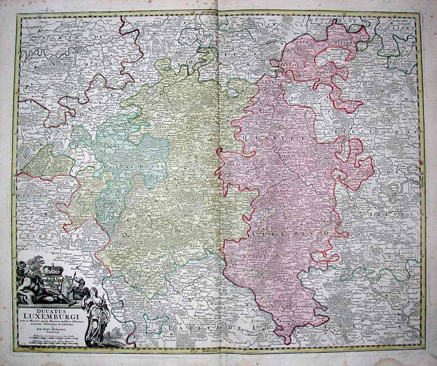
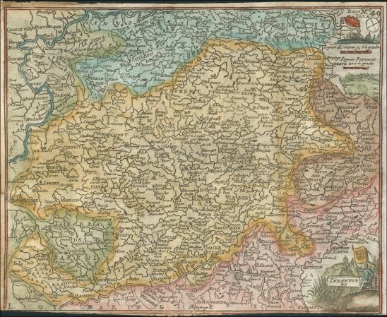
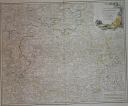
Ducatus Luxemburgi (1746). This map was originally published by Johann Baptist Homann (1664-1724). This state of the map includes a small cross atop the crown in the cartouche. [Vekene 3.07.b]
|
|
Luxemburg (1717). This map was engraved by Johann Stridbeck II (1616-1714). This state of the map was published by Gabriel Bodenehr and was included in Curioses Staats und Kriegs Theatrum. [Vekene 3.09.b]
|
|
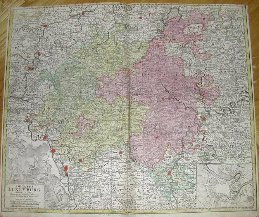
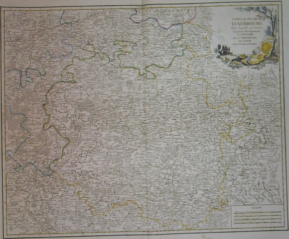
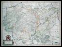
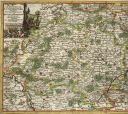
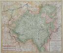
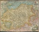
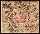
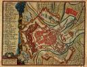
Ducatus Luxemburg (1730). This large map was published by Matthias Seutter in Augsburg in 1730. Note the inset plan of the town of Luxembourg in the lower right corner. [Vekene 3.14.C and 30.10]
|
|
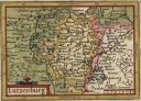
Le Duché de Luxembourg (1738). This map was published from an engraving made by Pieter van den Keere almost a century earlier and is based on a survey made by Jacques de Surhon. Only the cartouche was changed by the publisher Henri Du Sauzet of Amsterdam. [Vekene 3.15.A]
|
|
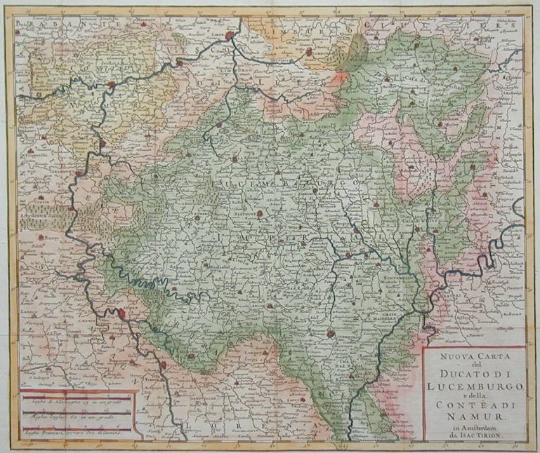
Nuova Carta del Ducato di Lucemburgo (1740). This map, engraved by Isaak Tirion, was published in 1740 by Giambatista Albrizzi of Venice in the atlas Atlante Novissimo del Sig. Guglielmo de L'Isle. It is the Italian version of a map originally published by Tirion in Dutch three years earlier. [Vekene 3.18.A]
|
|
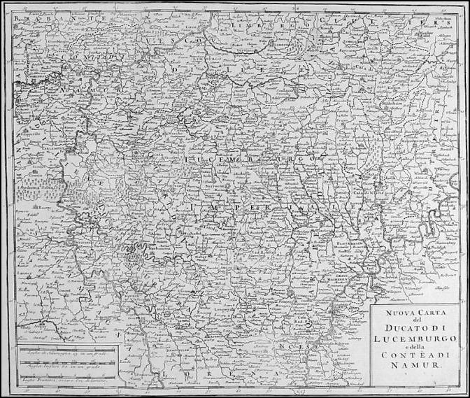
Nuova Carta del Ducato di Lucemburgo (1750). This map is identical to the previous one except that Tirion's name and the place of publication have been removed from the cartouche. It comes from the second edition of Atlante Novissimio, [Vekene 3.18.B]
|
|
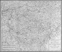
Ducatus Luxemburg (1735). From Seutter's Atlas Minor. [Vekene 3.19.A]
|
|
Duché de Luxembourg (1743). This map was published some time after 1743 by Georges-Louis LeRouge. It appeared in Atlas Nouveau portatif à l'usage des Militaires et du Voyageur as well as Introduction à la Géographie. [Vekene 3.23.B]
|
|
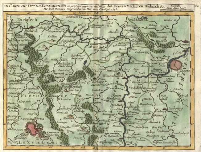
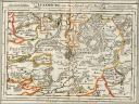
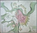
Carte du Dché du Luxembourg ou sont les environs de Luxembg Greven Macheren Diekirch &c. (1748). By Gilles Robert de Vaugondy [Le Sieur Robert] (1688-1766), from his Atlas Portatif of 1748-49. This map shows the central portion of the Duchy, including Luxembourg City, Diekirch, and Echternach. To the east is the city of Trier (Trèves). [Vekene 3.26.a-9]
|
|
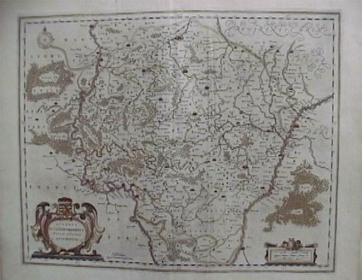
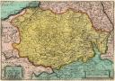
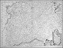
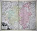
Carte du Dché de Luxembourg, dans laquelle on trouve la partie Meridionale & limitrophe de la Seigneurie de Lyege (1751). By Le Sr. Robert de Vaugondy (1688-1766), from his Atlas Universel of 1783-1799. This map shows the entire Duchy of Luxembourg and the southern part of the Bishopric of Liège bordering it. [Vekene 3.28.B]
|
|
Luzemburgo (1711). By Francisco de Afferden, essentially a copy of Jacques Harrewijn's map of 1692 (see above). This map first appeared in the 1711 edition of El atlas abreviado y compendiosa geografia, published by Francisco Laso. [Vekene 3.37]
|
|
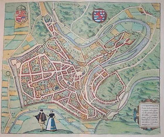
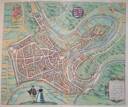
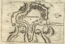
Luxembourg (1581). This first plan of the town of Luxembourg was engraved by Franz Hogenberg and is based on a 1560 survey by Jacob Van Deventer. It appeared in Volume III of the famous Civitates orbis terrarum, a magnificent collection of bird's eye views of towns of the world. This work was published in Köln by Georg Braun and Franz Hogenberg. [Vekene 10.01.A]
|
|
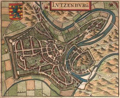
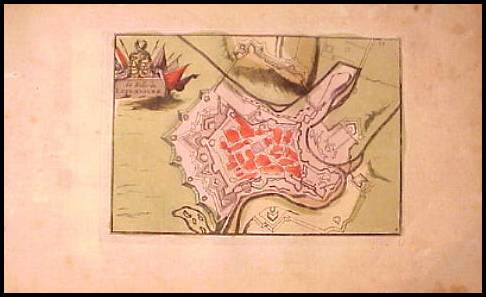
Lutzenbourg (1581). Engraved by Mynken Liefrinck and also based on Jacob Van Deventer's 1560 survey. From Lodovico Guicciardini's Italian edition of Descrittione... di tutti i Paesi Bassi... This work was published in Antwerp by Christophe Plantin. [Vekene 10.02.A]
|
|
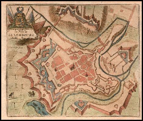
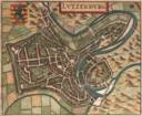
Lutzenburg (1652). This small plan of the town was published for the first time by Joannes Janssonius in Belgicae, sive inferioris Germaniae, descriptio: Auctore Ludovico Guicciardino Nobili Florentino. This particular copy is from an edition of this work published in Amsterdam, Apud Jacobum Meursium, 1660. [Vekene 20.06]
|
|
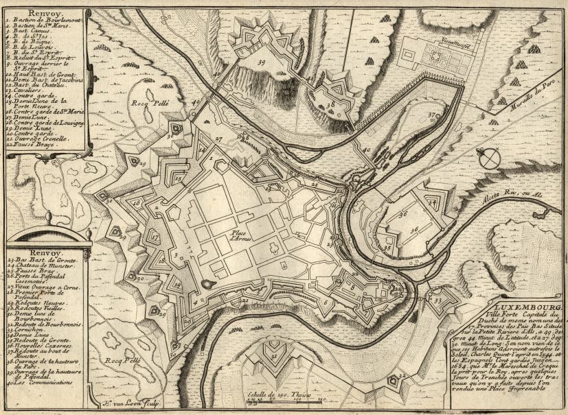
Luxembourg (1693). This plan of the town of Luxembourg was engraved by Harmanus van Loon. It was published by Nicolas de Fer in Paris in his Suitte des Forces de l'Europe ou Quatrième Partie de l'Introduction à la Fortification. [Vekene 20.35.A]
|
|
la Ville de Luxembourg (1711). This plan was engraved by Jacques Harrewijn (1660-1727) and is from Les Délices des Pais-Bas, published by François Foppens in Brussels. This is the second state of the engraving, showing three churches inside the fortress and picturing three surveyors at work in the fields outside the walls. [Vekene 20.40.B]
|
|
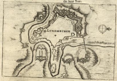
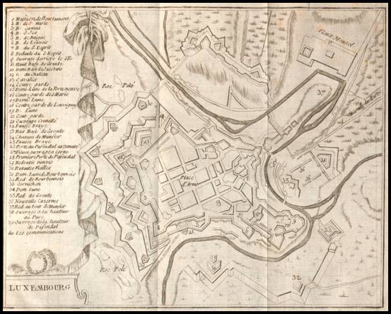
Luxemburgh (1695). This plan was engraved by Herman Moll (16xx-1732) and is from an early edition of Thesaurus Geographicus, published by Abel Swall & Tim. Child in London. It is a simplified city plan of Luxembourg, one of a series drawn and engraved by Moll to illustrate the main fortified towns of Europe. The plan is on a page with text describing The Dutchy of Luxemburg, Luxemburgensis Ducatus. On the reverse side is more text and a plan of the fortified town of Namur. [Vekene 30.01.A]
|
|
La Ville de Luxembourg (1735). This map was first published in Daniel de la Feuille's Atlas Portatif of 1702. It is very similar to a map published by Harrewijn in 1697. [Vekene 30.02]
|
|
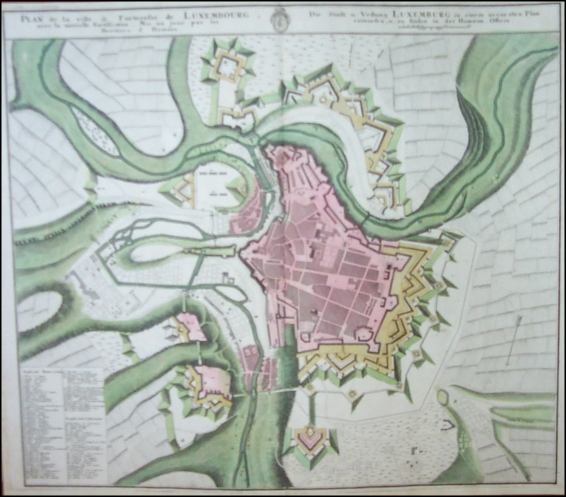
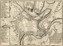
Plan de la ville & Forteresse de Luxembourg (1732/35). This plan of the fortress was engraved by Johann Georg Ebersberger (1695-1760) who, from 1730, together with Michel Franz, ran the geographic business founded by Homann. It shows several fortifications that were completed in 1729, 1730, and 1731. The map appeared in Grosser atlas, worinnen enthalten all die jenige geographische universal- special- und particular-mappen, published by Homann Heirs of Nürnberg. [Vekene 30.12]
|
|
Luxembourg (1720). This is a plan of the fortress capital city of Luxembourg. It was engraved by Jacob Harrewijn (1660-1727) and appeared in editions of Les Délices des Pays-Bas, published by J.F. Bassompierre of Liège up to 1769. [Vekene 30.29]
|
|
Luxembourg (1785). This is a less detailed copy of the previous map. It appeared in Het Schouwburg der Nederlanden, published by C.M. Spanoghe in Antwerp. [Vekene 30.31]
|